Close cookie details

This site uses cookies. Learn more about cookies.

OverDrive would like to use cookies to store information on your computer to improve your user experience at our Website. One of the cookies we use is critical for certain aspects of the site to operate and has already been set. You may delete and block all cookies from this site, but this could affect certain features or services of the site. To find out more about the cookies we use and how to delete them, click here to see our Privacy Policy.

If you do not wish to continue, please click here to exit this site.

Hide notification

  Main Nav
A History of the World in 12 Maps
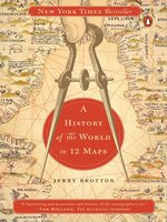
Cover of A History of the World in 12 Maps
A History of the World in 12 Maps
Borrow Borrow
A New York Times Bestseller
 
“Maps allow the armchair traveler to roam the world, the diplomat to argue his points, the ruler to administer his country, the warrior to plan his campaigns and the propagandist to boost his cause… rich and beautiful.” – Wall Street Journal
Throughout history, maps have been fundamental in shaping our view of the world, and our place in it. But far from being purely scientific objects, maps of the world are unavoidably ideological and subjective, intimately bound up with the systems of power and authority of particular times and places. Mapmakers do not simply represent the world, they construct it out of the ideas of their age. In this scintillating book, Jerry Brotton examines the significance of 12 maps - from the almost mystical representations of ancient history to the satellite-derived imagery of today. He vividly recreates the environments and circumstances in which each of the maps was made, showing how each conveys a highly individual view of the world. Brotton shows how each of his maps both influenced and reflected contemporary events and how, by considering it in all its nuances and omissions, we can better understand the world that produced it.
Although the way we map our surroundings is more precise than ever before, Brotton argues that maps today are no more definitive or objective than they have ever been. Readers of this beautifully illustrated and masterfully argued book will never look at a map in quite the same way again.

“A fascinating and panoramic new history of the cartographer’s art.”
The Guardian
 
“The intellectual background to these images is conveyed with beguiling erudition…. There is nothing more subversive than a map.”
– The Spectator
 
“A mesmerizing and beautifully illustrated book.”
The Telegraph

Available formats-
  • OverDrive Read
  • EPUB eBook
Languages:-
Copies-
  • Available:
    1
  • Library copies:
    1
Levels-
  • ATOS:
  • Lexile:
  • Interest Level:
  • Text Difficulty:


Excerpts-
  • From the book Introduction

    Sippar (Tell Abu Habbah, modern-day Iraq), sixth century BC

    In 1881 , the Iraqi-born archaeologist Hormuzd Rassam discovered a small fragment of a 2 , 500 -year-old cuneiform clay tablet in the ruins of the ancient Babylonian city of Sippar, today known as Tell Abu Habbah, on the south-west outskirts of modern-day Baghdad. The tablet was just one of nearly 70 , 000 excavated by Rassam over a period of eighteen months and shipped back to the British Museum in London. Rassam’s mission, inspired by a group of English Assyriologists who were struggling to decipher cuneiform script, was to discover a tablet which it was hoped would provide a historical account of the biblical Flood.1 At first, the tablet was overlooked in favour of more impressive, complete examples. This was partly because Rassam, who could not read cuneiform, was unaware of its significance, which was appreciated only at the end of the nineteenth century when the script was successfully translated. Today, the tablet is on public display at the British Museum, labelled as ‘The Babylonian Map of the World’. It is the fi rst known map of the world.

    The tablet discovered by Rassam is the earliest surviving object that represents the whole world in plan from a bird’s-eye view, looking down on the earth from above. The map is composed of two concentric rings, within which are a series of apparently random circles, oblongs and curves, all of which are centred on a hole apparently made by an early pair of compasses. Evenly distributed around the outer circle are eight triangles, only five of which remain legible. Only when the cuneiform text is deciphered does the tablet begin to make sense as a map.

    The outer circle is labelled ‘marratu’, or ‘salt sea’, and represents an ocean encircling the inhabited world. Within the inner ring the most prominent curved oblong running through the central hole depicts the Euphrates River, fl owing from a semicircle in the north labelled ‘moun­tain’, and ending in the southern horizontal rectangle described as ‘channel’ and ‘swamp’. The rectangle bisecting the Euphrates is labelled ‘Babylon’, surrounded by an arc of circles representing cities and regions including Susa (in southern Iraq), Bit Yakin (a district of Chaldea, near where Rassam himself was born), Habban (home of the ancient Kassite tribe), Urartu (Armenia), Der and Assyria. The triangles emanating out­wards from the outer circle of sea are labelled ‘nagû’, which can be translated as ‘region’ or ‘province’. Alongside them are cryptic legends describing distances (such as ‘six leagues between where the sun is not seen’),2 and exotic animals – chameleons, ibexes, zebus, monkeys, ostriches, lions and wolves. These are uncharted spaces, the mythical, faraway places beyond the circular limits of the known Babylonian world.

    The cuneiform text at the top of the tablet and on its reverse reveals that this is more than just a map of the earth’s surface: it is a compre­hensive diagram of Babylonian cosmology, with the inhabited world as its manifestation. The tantalizing fragments speak of the creation myth of the battle between the Babylonian gods Marduk and Ti’amat. In Babylonian mythology, Marduk’s victory over what the tablet calls the ‘ruined gods’ led to the foundation of heaven and earth, humanity and language, all centred on Babylon, created ‘on top of the restless sea’. The tablet, made from the earth’s clay, is a physical expression of Marduk’s...

Reviews-
  • Publisher's Weekly

    Starred review from September 2, 2013
    In an era when Google Maps is regarded as a standard convenience, this history of 12 epoch-defining maps—including Google’s—is a revelation. Renaissance scholar Brotton examines a cross-cultural sampling of historic world maps, exploring them as representations of both the Earth, and of the philosophical mores of the cultures that produced them. The maps range in function from the “practical maintenance of empire” to the spiritual concerns of uniting “the earth and the heavens in a harmonious, universal whole.” Each simultaneously represents a geographical survey, an aesthetic achievement, technological progress, theological instruction, and political demarcation. These multiple functions are mirrored in the structure of the book, which reflects political, philosophical, and cultural development. The maps are about humanity’s changing relationship with itself, others, the Earth, and the heavens, and this broad scope makes for rich reading. Ultimately, the unifying function of each map is to “rise above the earth” and see with a “divine perspective,” and Brotton offers an excellent guide to understanding these influential attempts at psychogeographical transcendence. Of course, each historic map, despite the cartographer’s efforts, contained inaccuracies, necessitating revisions—a humbling lesson for our current information-dense age. Maps.

  • Kirkus

    October 15, 2013
    A deeply erudite work of epistemology tracking how the making of maps throughout the ages reveals mankind's mastery of the universe. In this wide-ranging work, English scholar Brotton (Renaissance Studies/Queen Mary Univ.; The Sale of the Late King's Goods: Charles I and His Art Collection, 2006, etc.) moves from Ptolemy's Geography (A.D. second century) to Google Earth for an eclectic representation of the power of maps to confer man's authority and dominion. Maps tell us what we know about ourselves in relation to the world but also what we want the viewer to know, drawing on shifting perception, orientation and direction throughout the ages as science, faith and egocentrism deepened. For example, most of these 12 maps spotlight the culture from which the mapmaker drew, and until the later Christian era, maps were "oriented" by the south rather than north. Brotton divides his work into discrete themes such as science, faith, money and equality, selecting the map that best represents that particular idea at some moment in history. For example, Geography encapsulated more than 1,000 years of Greek thinking on the world "as a single and continuous entity" and was used as a model for the next two millennia. Muhammad al-Idrisi's Entertainment (A.D. 1154) reveals the enormously rich exchange of ideas between the Muslim East and Christian West. The bishop of Hereford's Mappamundi (1300) depicts fanciful theological events both classical and biblical, with Jerusalem at its center. Gerard Mercator's World Map (1569) shows how the extraordinary mapmaker circumscribed the persecution of his Protestant faith by rendering a vast map for navigation using a combination of cosmographical tradition and new scientific understanding. Brotton explores the ideology behind each mapmaker and the compelling "emotional forces" that he reveals about our civilization. A dense and scholarly but rewarding journey for the intellectually intrepid.

    COPYRIGHT(2013) Kirkus Reviews, ALL RIGHTS RESERVED.

  • Booklist

    September 15, 2013
    Maps, both ancient and current, can reveal more than hard, physical facts such as rivers, mountains, and lines of latitude and longitude. They can also indicate the perceptions and biases of the cartographers and the cultures in which they labored. That is a recurring theme throughout this striking collection of maps, ranging from a world map based on Ptolemy's second-century CE calculations, to a current Google Earth map. The maps and excellent commentaries that accompany them illustrate, of course, the advances of scientific knowledge about the earth. But they also show how these creators were influenced by their ethnocentric views and the political pressures of various interest groups. For example, a map from medieval Europe shows the Far East as a land under the sway of cannibals and outcasts, while a Chinese map portrays lands to the west controlled by savages. This is a stimulating and thought-provoking study of how the mixing of science, politics, and even religion influenced and continues to influence cartography(Reprinted with permission of Booklist, copyright 2013, American Library Association.)

  • Library Journal

    June 15, 2013

    Maps would seem to represent a clear-cut reality, but as Brotton shows, they've often been used to push imperial, religious, or economic aims or ideas. Thus, the 12 maps he discusses here, which date from ancient Greece to Renaissance Europe to Google Earth and take in Buddhist and Islamic realms as well as the West, can give us in-depth cultural understanding of several millennia of human history.

    Copyright 2013 Library Journal, LLC Used with permission.

  • Library Journal

    December 1, 2013

    Brotton (Renaissance studies, Queen Mary Univ. of London; The Sale of the Late King's Goods: Charles I & His Art Collection) has produced an exhaustively researched historical study of world maps as a direct reflection of the geopolitical, cultural, and religious consciousness of their particular time and context. The 12 examples chosen span centuries and cultures, from Ptolemy's second-century study to 2012's Google Earth. One particularly noteworthy chapter, "Exchange," provides an account of al-Idrisi's world map (1154). This cartographer, a Muslim commissioned by Christian King Roger II of Sicily, brought to his work both Latin and Arabic geographical knowledge. Brotton demonstrates how choice of perspective and projection can deliberately enhance or diminish terrestrial regions. North is at the top of our own maps, but early Christian maps used East, while early Islamic maps favored South. At the center could be Jerusalem, Mecca, Europe, or your home address via Google Earth. Richly illustrated with 52 period maps reproduced in full color from collections around the world. VERDICT This fascinating study will raise map consciousness and offer new cartographic insights. Although scholarly in tone, it is highly recommended for all map enthusiasts and anyone with an interest in historiography.--Edward K. Werner, St. Lucie Cty. Lib. Syst., Ft. Pierce, FL

    Copyright 2013 Library Journal, LLC Used with permission.

Title Information+
  • Publisher
    Penguin Publishing Group
  • OverDrive Read
    Release date:
  • EPUB eBook
    Release date:
Digital Rights Information+
  • Copyright Protection (DRM) required by the Publisher may be applied to this title to limit or prohibit printing or copying. File sharing or redistribution is prohibited. Your rights to access this material expire at the end of the lending period. Please see Important Notice about Copyrighted Materials for terms applicable to this content.

Status bar:

You've reached your checkout limit.

Visit your Checkouts page to manage your titles.

Close

You already have this title checked out.

Want to go to your Checkouts?

Close

Recommendation Limit Reached.

You've reached the maximum number of titles you can recommend at this time. You can recommend up to 0 titles every 0 day(s).

Close

Sign in to recommend this title.

Recommend your library consider adding this title to the Digital Collection.

Close

Enhanced Details

Close
Close

Limited availability

Availability can change throughout the month based on the library's budget.

is available for days.

Once playback starts, you have hours to view the title.

Close

Permissions

Close

The OverDrive Read format of this eBook has professional narration that plays while you read in your browser. Learn more here.

Close

Holds

Total holds:


Close

Restricted

Some format options have been disabled. You may see additional download options outside of this network.

Close

MP3 audiobooks are only supported on macOS 10.6 (Snow Leopard) through 10.14 (Mojave). Learn more about MP3 audiobook support on Macs.

Close

Please update to the latest version of the OverDrive app to stream videos.

Close

Device Compatibility Notice

The OverDrive app is required for this format on your current device.

Close

Bahrain, Egypt, Hong Kong, Iraq, Israel, Jordan, Kuwait, Lebanon, Libya, Mauritania, Morocco, Oman, Palestine, Qatar, Saudi Arabia, the Sudan, the Syrian Arab Republic, Tunisia, Turkey, the United Arab Emirates, and Yemen

Close

You've reached your library's checkout limit for digital titles.

To make room for more checkouts, you may be able to return titles from your Checkouts page.

Close

Excessive Checkout Limit Reached.

There have been too many titles checked out and returned by your account within a short period of time.

Try again in several days. If you are still not able to check out titles after 7 days, please contact Support.

Close

You have already checked out this title. To access it, return to your Checkouts page.

Close

This title is not available for your card type. If you think this is an error contact support.

Close

An unexpected error has occurred.

If this problem persists, please contact support.

Close

Close

NOTE: Barnes and Noble® may change this list of devices at any time.

Close
Buy it now
and help our library WIN!
A History of the World in 12 Maps
Jerry Brotton
Choose a retail partner below to buy this title for yourself.
A portion of this purchase goes to support your library.
Close
Close

There are no copies of this issue left to borrow. Please try to borrow this title again when a new issue is released.

Close
Barnes & Noble Sign In |   Sign In

You will be prompted to sign into your library account on the next page.

If this is your first time selecting “Send to NOOK,” you will then be taken to a Barnes & Noble page to sign into (or create) your NOOK account. You should only have to sign into your NOOK account once to link it to your library account. After this one-time step, periodicals will be automatically sent to your NOOK account when you select "Send to NOOK."

The first time you select “Send to NOOK,” you will be taken to a Barnes & Noble page to sign into (or create) your NOOK account. You should only have to sign into your NOOK account once to link it to your library account. After this one-time step, periodicals will be automatically sent to your NOOK account when you select "Send to NOOK."

You can read periodicals on any NOOK tablet or in the free NOOK reading app for iOS, Android or Windows 8.

Accept to ContinueCancel